Application Description
City routes, live traffic, transit routes, parking, offline map and navigation.
We are excited to announce the latest updates to 2GIS, which has evolved to better showcase the wealth of information about cities and businesses. The new version of 2GIS features a refreshed design, an enhanced search function, improved city updates, and the integration of favorites with 2gis.ru.
Services, Addresses, and Companies
2GIS provides comprehensive details on which service providers operate in your area, the locations of local hospitals, and post offices. It assists in selecting cafes or service centers based on reviews and photos, and displays their operating hours and contact numbers.
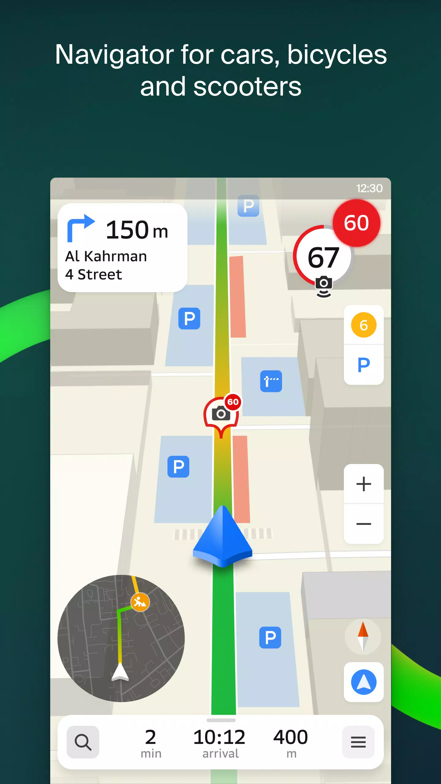
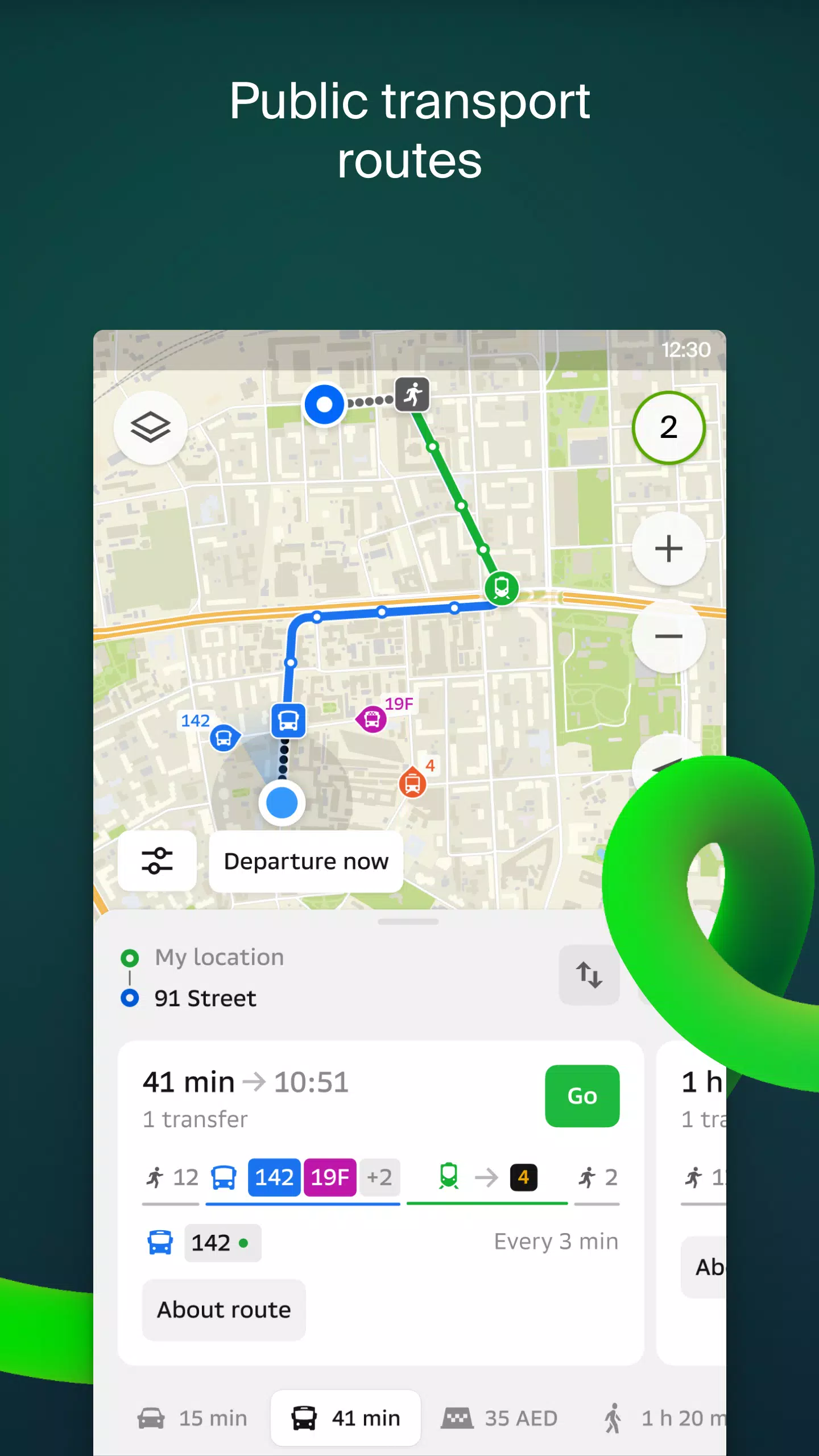
Transport and Navigation
For drivers, 2GIS offers real-time navigation with voice-guided instructions, taking into account traffic conditions and road closures. It dynamically updates your route if you deviate from the planned path. For pedestrians, it suggests routes using buses, metro, trains, cable cars, and river trams.
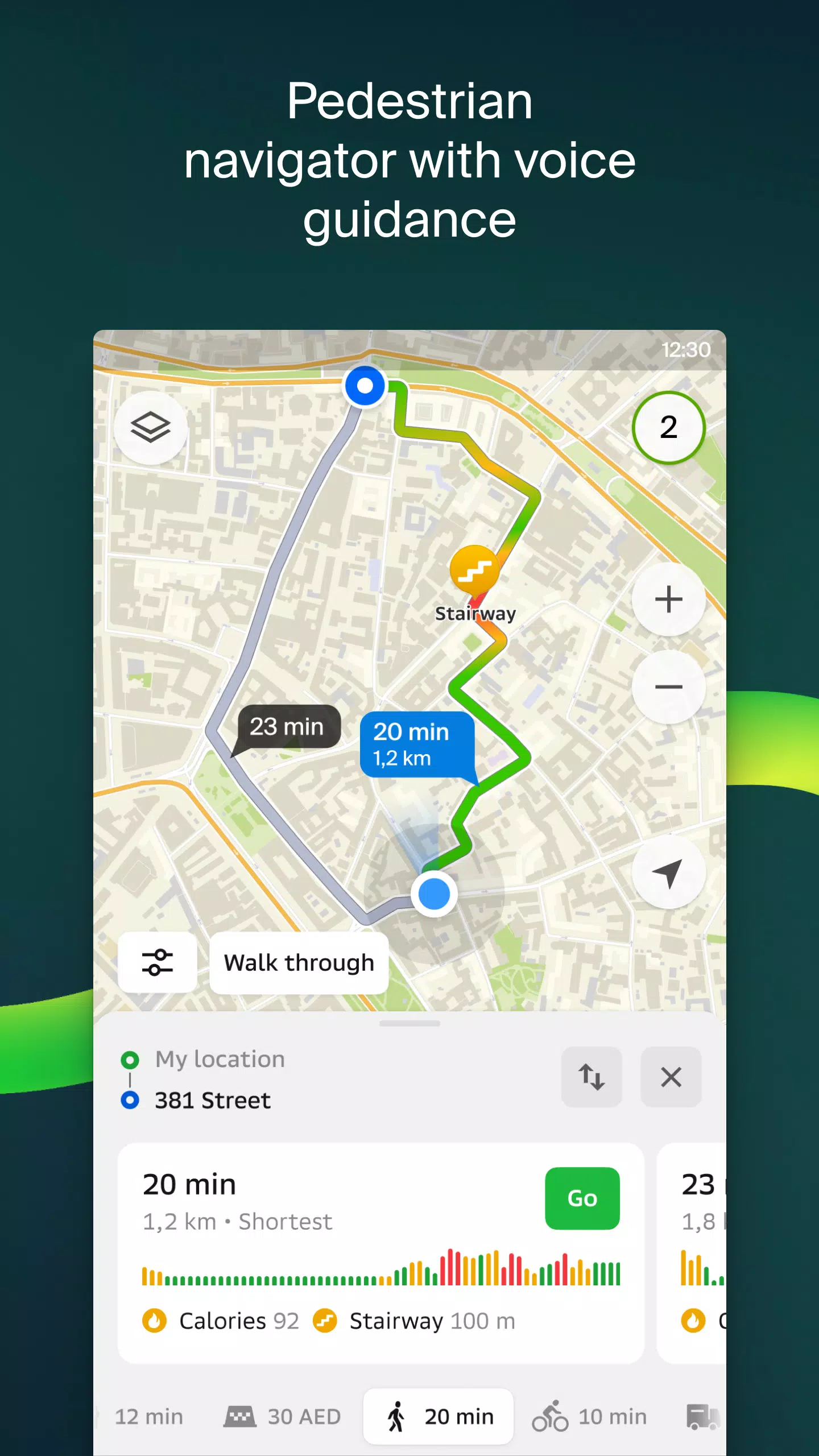
Walking Routes
Our pedestrian navigation feature guides you on foot to your destination, complete with background operation and voice guidance.
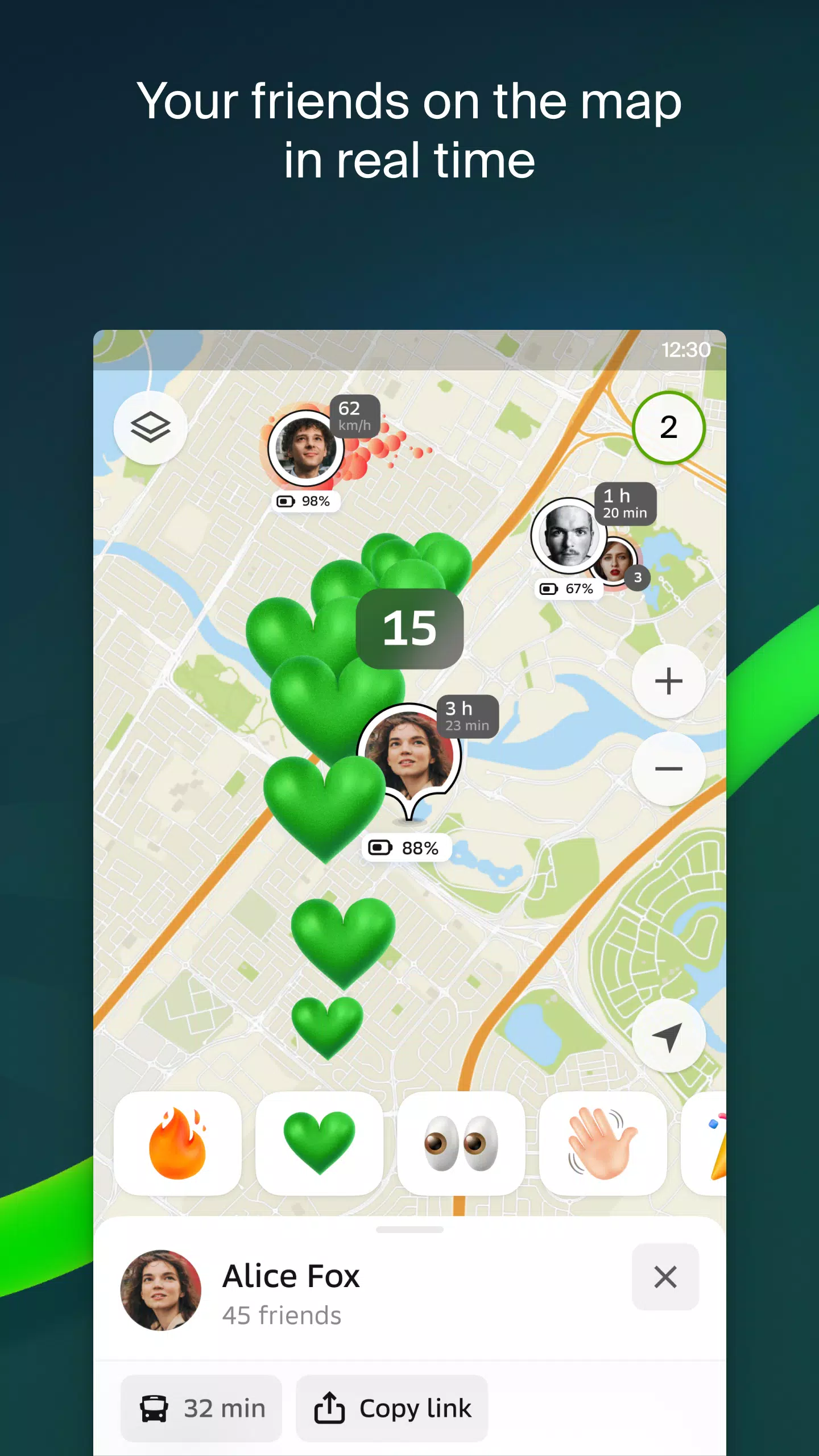
Friends on the Map
With 2GIS, you can now locate your friends and family in real-time on the map. You have control over who you add as a friend and who can view your location, with privacy settings at your fingertips.
Building Entrances
No more wandering around to find the entrance to a business center. 2GIS provides access information for over 2.5 million companies, guiding you right to the door, whether you're using public transport or driving.
Plans of Shopping Centers
Navigate effortlessly within shopping centers with 2GIS, which details everything from stores and cafes to ATMs and restrooms, helping you plan your visit in advance.
2GIS Beta Notifications Companion App for Smart Watches
Enhance your navigation experience with our new companion app for Wear OS smartwatches. It supports route navigation for walking, cycling, or public transport directly from the main 2GIS beta app. Features include map viewing, maneuver hints, and vibration alerts for turns or approaching bus stops. The app auto-starts when you initiate navigation on your phone and is compatible with Wear OS 3.0 and later.
By joining the 2GIS beta program, you'll receive the latest updates and contribute to the development of a new version that will serve millions of users. You can run both the original and beta versions simultaneously, switching between them as needed.
Support: [email protected]
What's New in the Latest Version 6.44.1.559.3
Last updated on Oct 19, 2024
We're thrilled to share our latest enhancements designed to improve your experience:
- Enjoy more realistic road visuals on the main map and during route searches.
- Connect with friends through our new in-app Chats feature, allowing you to message directly on the map.
- Receive notifications when friends are nearby, with the option to disable this in settings.
- Stay updated on ski lift statuses as we gear up for the ski season.
- For mixed public transport and walking routes, we now calculate the walking segments in steps for more precise navigation.
Maps & Navigation


 Apps like 2GIS beta