Application Description
Your Comprehensive Guide to Hiking, Cycling, Skiing, and Ski Alps by Car and Public Transport
Embark on your next adventure with confidence using our versatile app designed for hiking, cycling, skiing, and exploring ski alps, whether you're traveling by car or public transport. Our app is your ultimate companion, offering a plethora of features to ensure your journey is both enjoyable and well-planned.
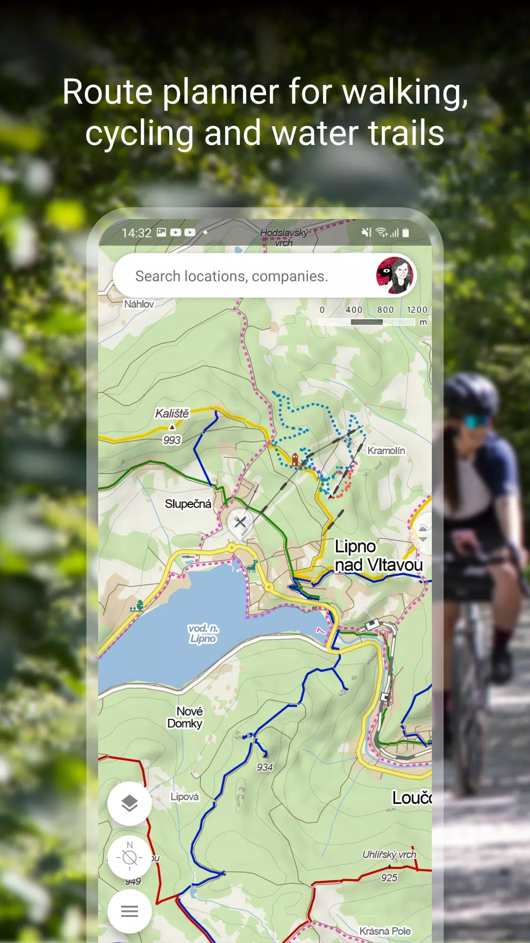
Plan Your Route
Explore the great outdoors with ease. Our app includes detailed maps for:
- Hiking and cycling trails
- Cross-country skiing and ski-alpine trails
Enhance your trip with our unique “travel tips” feature, which curates a journey through the most fascinating spots in your chosen area. Get a comprehensive view with route elevation profiles and stay prepared with 5-day weather, temperature, wind, and precipitation forecasts for any location worldwide.
Browse the Tourist Map of the Whole World
Navigate effortlessly with our world tourist map, showcasing:
- Hiking trails, bike trails, singletracks, and single trails
- Roads, mixed cycle paths, unpaved paths, and footpaths
- Hillshade anywhere in the world, along with ferrata and their difficulty levels
- Educational trails, pedestrian closures, and national park zones
- Routes suitable for wheelchair users
Switch to Other Map Layers
Dive deeper with additional map layers, including:
- Aerial maps of the world
- Panoramic images of Czech streets and 3D views
- Winter maps featuring up-to-date cross-country ski trails and ski resorts
- Traffic maps showing current conditions, closures, and parking zones in the Czech Republic
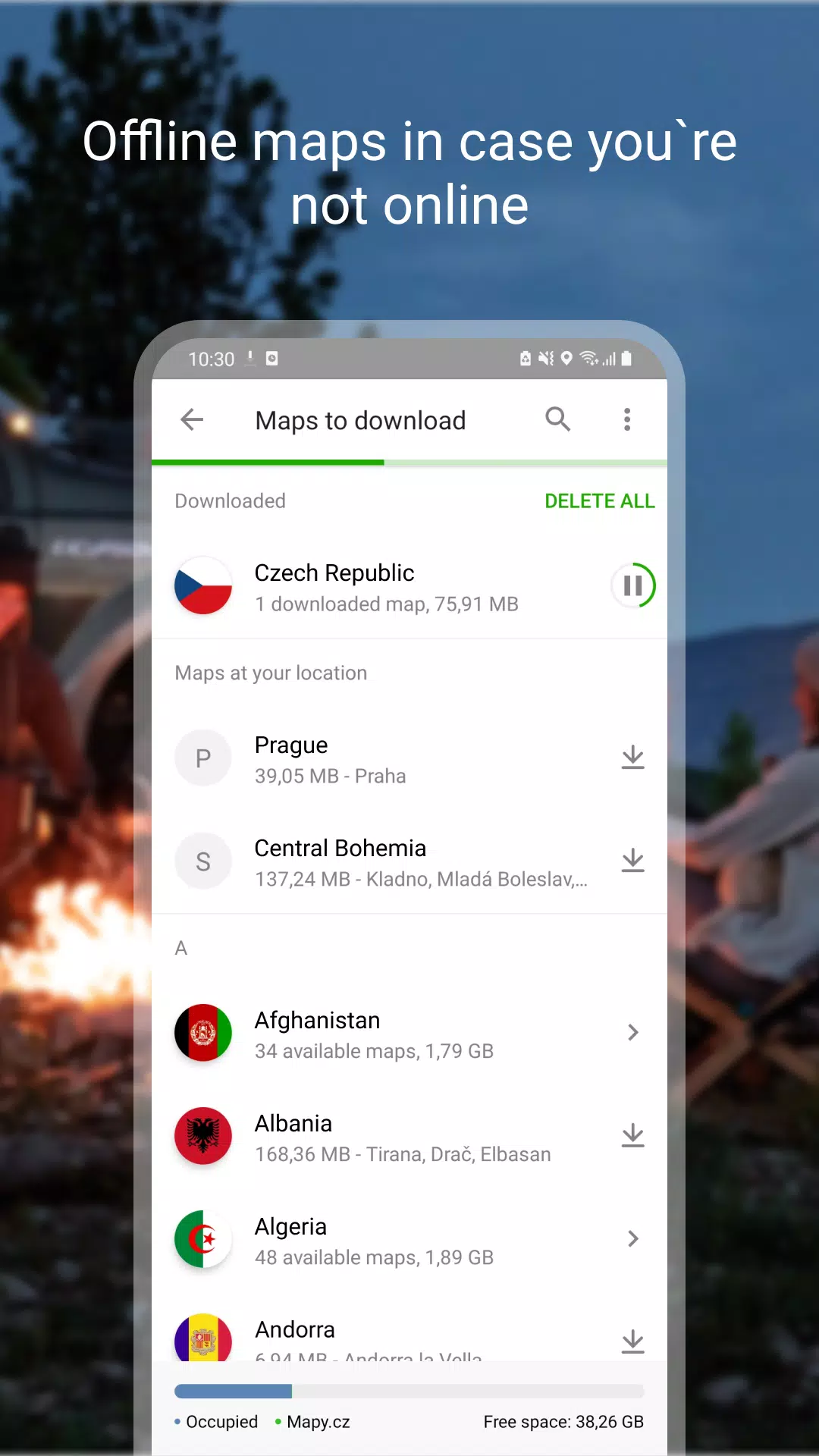
Download Offline Maps
Stay connected even when you're off the grid with our offline capabilities:
- Offline tourist map of the whole world with hiking and cycling trails
- Offline voice navigation for drivers, cyclists, and pedestrians
- Offline winter maps of the Czech Republic with cross-country skiing trails and ski resorts
- Download individual regions for navigation
- Search for places and plan routes globally, even without a signal
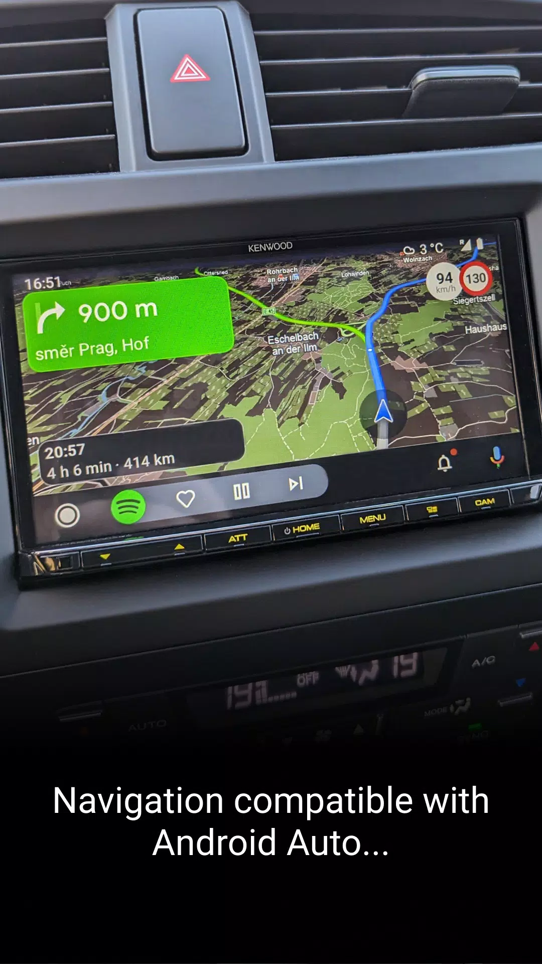
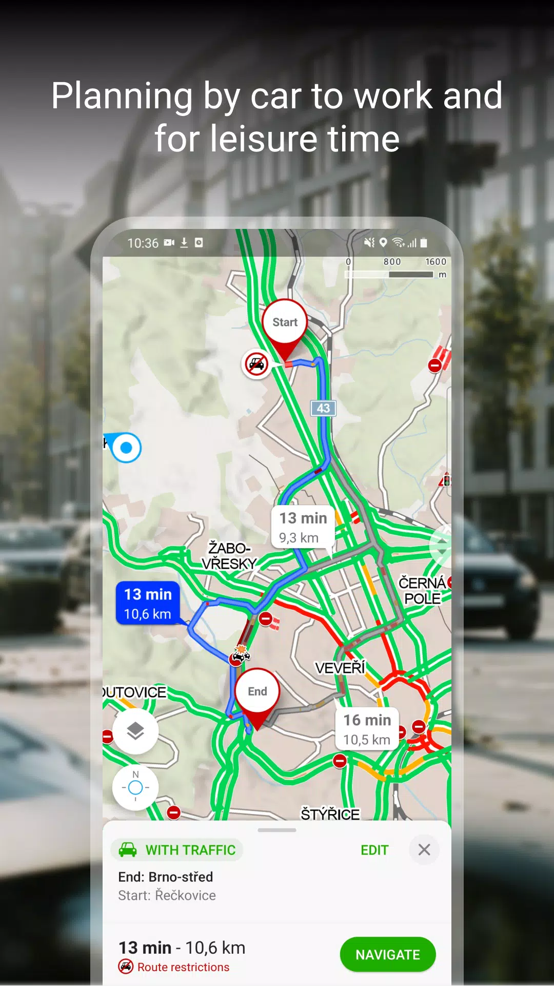
Free Navigation for Drivers, Cyclists, and Pedestrians
Navigate with ease thanks to our user-friendly features:
- Clear instructions on which lane to enter
- Highlighting of roundabout exits
- Ability to avoid toll lanes
- Dark mode for navigation
- Share arrival times, routes, and current locations via SMS, email, or chat
- View navigation on large on-board displays via Android Auto and Apple CarPlay
- Speeding alerts and speed camera notifications for the Czech Republic
- Real-time traffic updates and accident warnings in the Czech Republic
- Latest traffic situation in the Czech Republic with traffic jams and alternative routes
- Warnings for sections with frequent traffic accidents and areas without winter maintenance
Save to My Maps
Organize your adventures effortlessly:
- Save places, routes, photos, and activities in clear folders
- Track activities with Tracker for walking, cycling, running, cross-country skiing, and hiking
- GPX file upload, import, and export
- Synchronize planned routes across devices
Choose by Reviews of Places, Restaurants, and Services
Make informed decisions with:
- Up-to-date user photos showing what places look like
- User experiences with food, service, ambience, and price
- Search by rating level and highlight top-rated establishments
Recommendations and Tips:
- An internet connection is required to download maps
- Enable location services in your phone settings for optimal app functionality
- Access to background location data is necessary for the location sharing feature
- Use the in-app form in settings for questions or troubleshooting
- Running the app in the background with GPS can reduce battery life
- Join our user community at www.facebook.com/Mapy.cz/ to share your experiences, stay updated, and suggest new features
With our comprehensive app, you're equipped to explore the world with confidence and ease. Whether you're hiking, cycling, skiing, or navigating the ski alps, we've got you covered for an unforgettable adventure.
Maps & Navigation


 Apps like Mapy.cz: maps & navigation