Application Description
2GIS offers an all-in-one solution for navigation and exploration, providing offline maps, GPS navigation, real-time traffic updates, parking information, and transit routes to enhance your travel experience. Whether you're driving, walking, or using public transport, 2GIS equips you with the tools you need to navigate with confidence.
Download the 2GIS map to your device and use it offline, ensuring you never get lost, even without an internet connection. With detailed city maps, you'll feel at home in unfamiliar places as you:
- Easily find addresses, businesses, phone numbers, operating hours, products, or services;
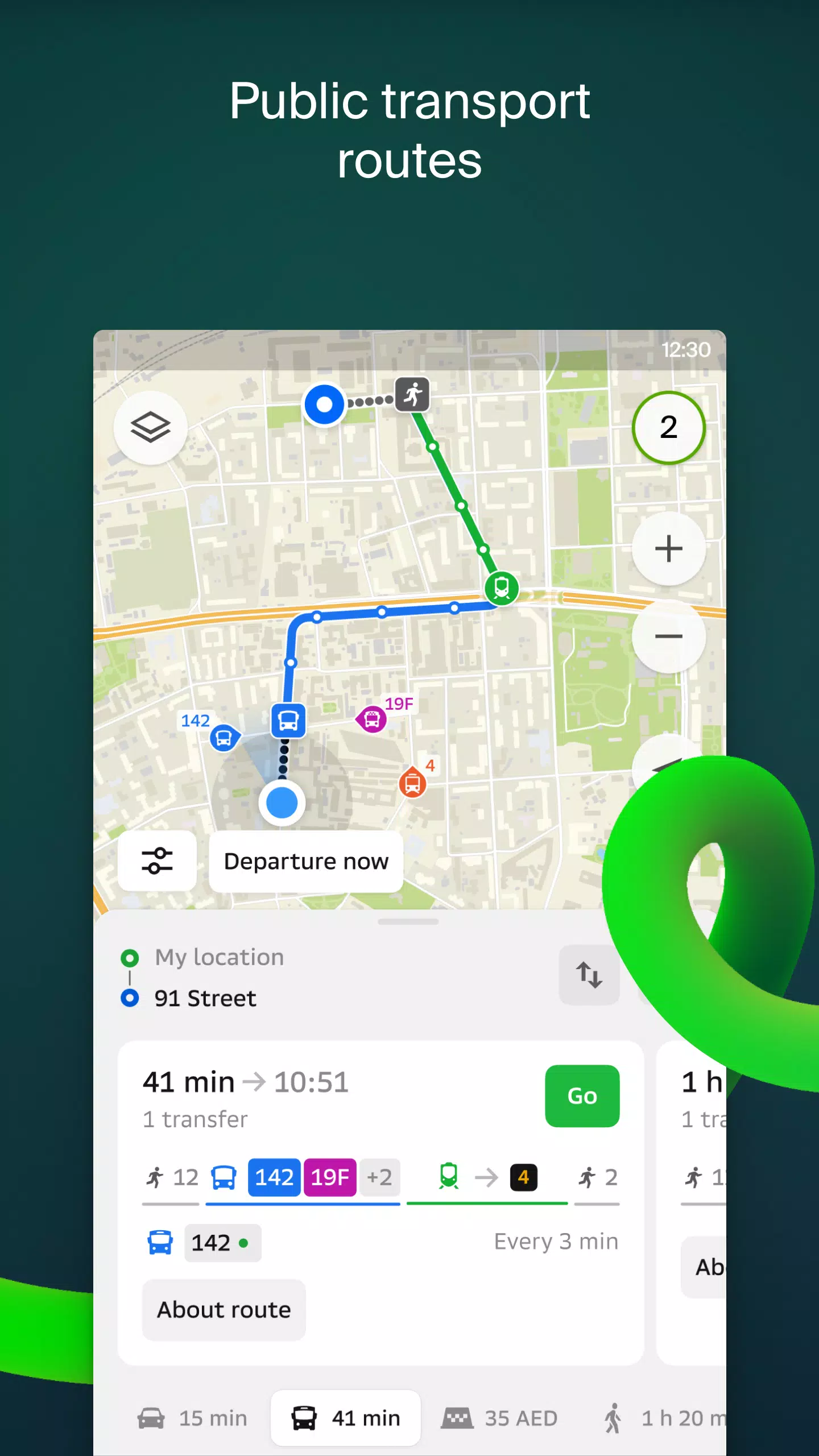
- Discover the best way to reach your destination by car, bus, subway, or follow pedestrian navigation;
- Locate building entrances and nearby parking lots.
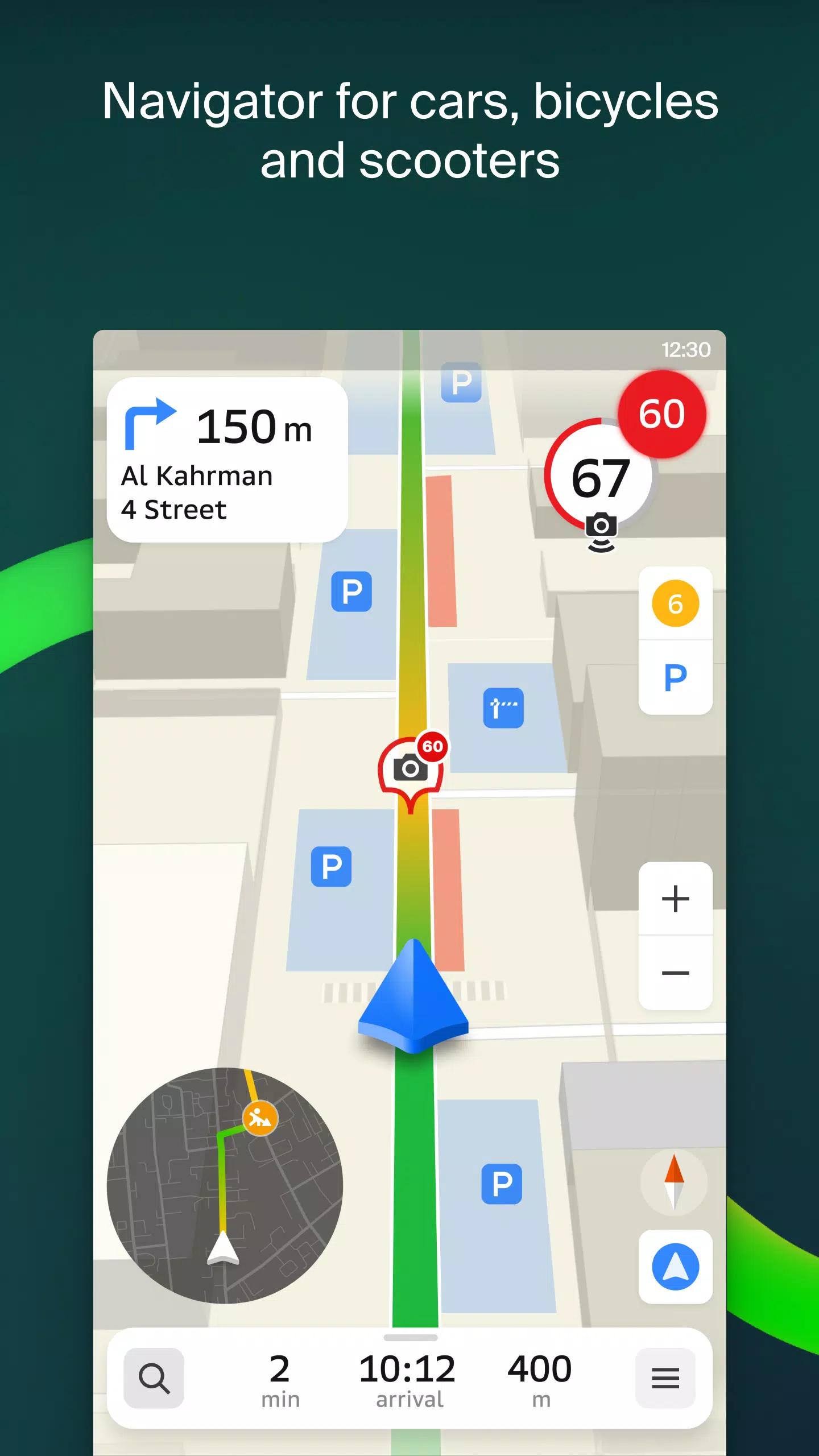
2GIS features highly accurate maps that pinpoint districts, buildings, streets, bus stops, subway stations, gas stations, sports grounds, and many other points of interest. The GPS navigation system takes into account live traffic conditions, road signs, speed cameras, toll roads, and unpaved routes, offering seamless navigation between cities and through multiple points. Additionally, there's a free app compatible with Android Auto.
Stay connected with friends and family through 2GIS's live location feature, which lets you track your kids or friends on the map for added safety. You can share fun stickers and monitor battery levels, all while controlling who sees your location through customizable sharing settings.
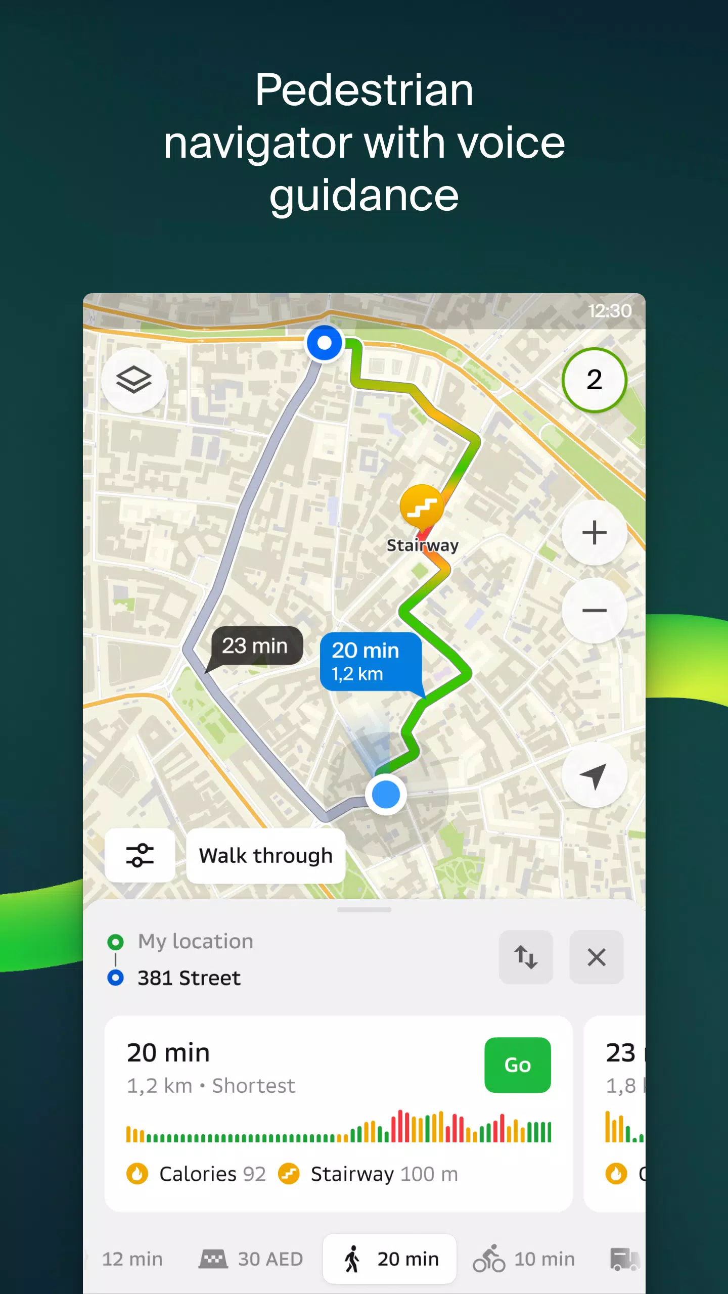
Stay updated with road events, including accidents, blocked streets, and speed camera locations, all displayed directly on the map alongside user comments. For public transport users, 2GIS provides schedules and real-time transit routes, while pedestrian navigation guides you on foot with voice guidance, even when the app is running in the background.
For truck drivers, 2GIS offers specialized navigation tailored to the unique requirements of your vehicle and cargo. The detailed directory feature includes addresses, entrances, postal codes, phone numbers, operating hours, social media links, and websites, enriched by user photos and reviews.
Explore new destinations with the travel guide, which highlights major attractions and Wi-Fi hotspots on the map. Enhance your navigation experience with the 2GIS Notifications companion app for smartwatches running Wear OS, offering hands-free route guidance and vibration alerts for turns and destination arrivals.
2GIS maps are available for numerous cities across the UAE, Russia, Belarus, Kazakhstan, Uzbekistan, Azerbaijan, and Kyrgyzstan, including Dubai, Moscow, Minsk, and many more. For support, reach out to [email protected].
Maps & Navigation


 Apps like 2GIS: Offline map & navigation